
Discover Your Next Adventure
Join us in exploring the beauty of our local trails. Here, you'll find resources and updates to enhance your journeys. Let's build a community of outdoor enthusiasts who value safety and connection. Dive in to see what awaits you!
Trails & Paths
Check out our list of trails that cater to all levels.
Check out our list of trails that cater to all levels. Whether you're a newbie or a seasoned biker, you'll find all the info you need to hit the trails safely and enjoyably. Let's get moving!
SKILL LEVELS
Beginner
Intermediate
Advanced
Expert
Cunningham Park
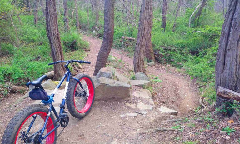
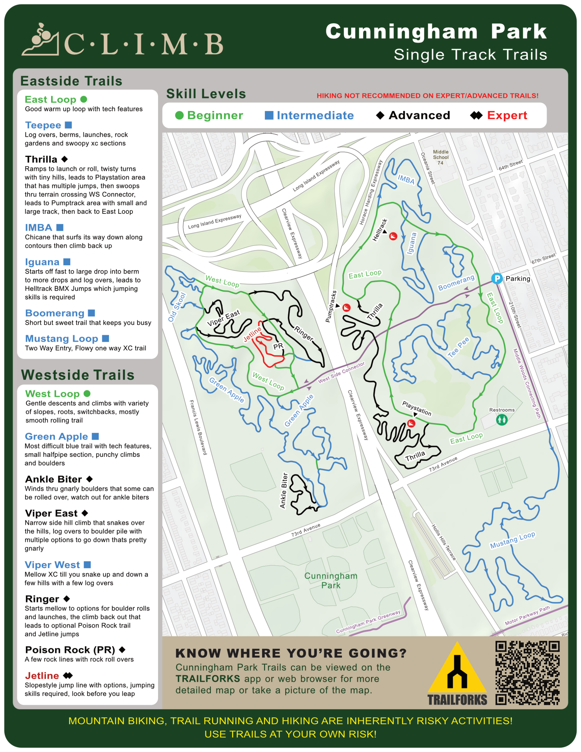
Some of the best legal singletrack in the area, with mountain biking permitted only in the North Woods and Middle Woods. The park is split by the Clearview Expressway, connected by a pedestrian bridge, and each side has roughly 3.5 miles of trail plus a 1.5‑mile loop in the Middle Woods. The terrain is mostly flat with minimal elevation, but the trails make the most of the natural landscape. Riders must follow the one‑way markers—green for beginner, blue for intermediate, and red for advanced—and avoid building or modifying trails. Helmets are required, and keeping the park clean is strongly encouraged.
The east side is the easier half, featuring doubletrack, beginner‑friendly singletrack, two pump tracks, a tabletop jump area, and a drop‑practice zone. The west side is more rugged, with tighter singletrack, steeper sections, a slopestyle jump line called the Jetline, and a parallel rock garden. A common route is to warm up on the east side, then follow the white trail to the pedestrian bridge and continue on the west side. The trailhead sits at 210th St. and 67th Ave., two blocks south of the LIE (495), and is accessible via the F and J trains, the Kissena Corridor, and the Motor Parkway Path.

SKILL LEVELS
Beginner
Intermediate
Advanced
Expert
Hempstead Harbor Woods
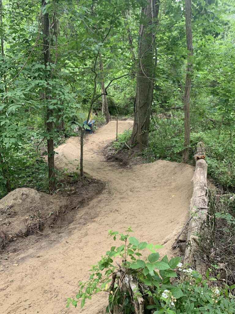
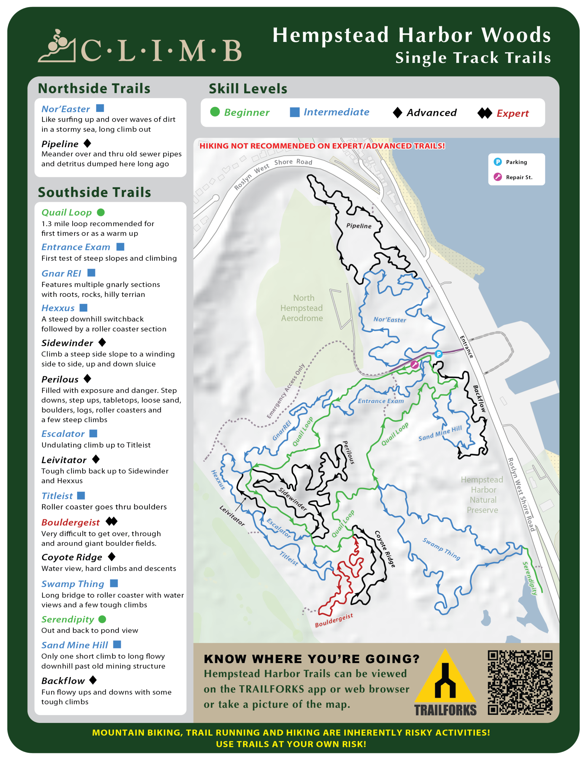
Hempstead Harbor Woods is a trail system in the Town of North Hempstead. The green trail is the most difficult green trail on Long Island and optional blue square, black diamond and Double black diamond are seriously gnarly. Start with a warm up loop on the green trail to get an idea of what you're in for. This is the site of former sand mining operations so you will find a fair amount of sand. There are also lots of areas with pure clay so it will be slippery and takes longer to dry out after rain. This trail is shared with hikers so be courteous, slow down when approaching hikers, call out a plan and pass safely. Please do not just zoom by and scare anyone. Do not enter the flying field area or the golf course. When parking do not block the trail entrances and exits. The main loop is about 1.25 miles and there are additional loops built off of that.
SKILL LEVELS
Beginner
Intermediate
Advanced
Bethpage State Park
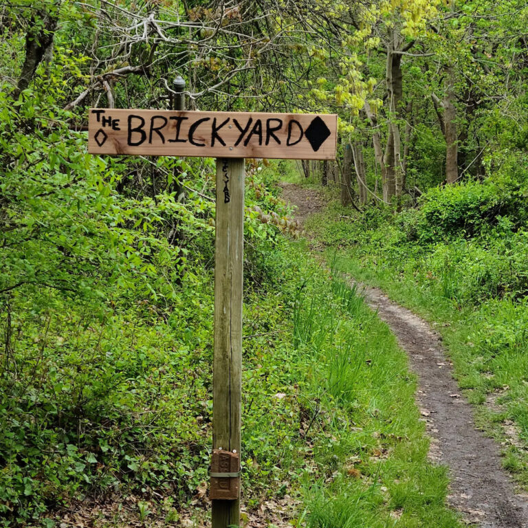
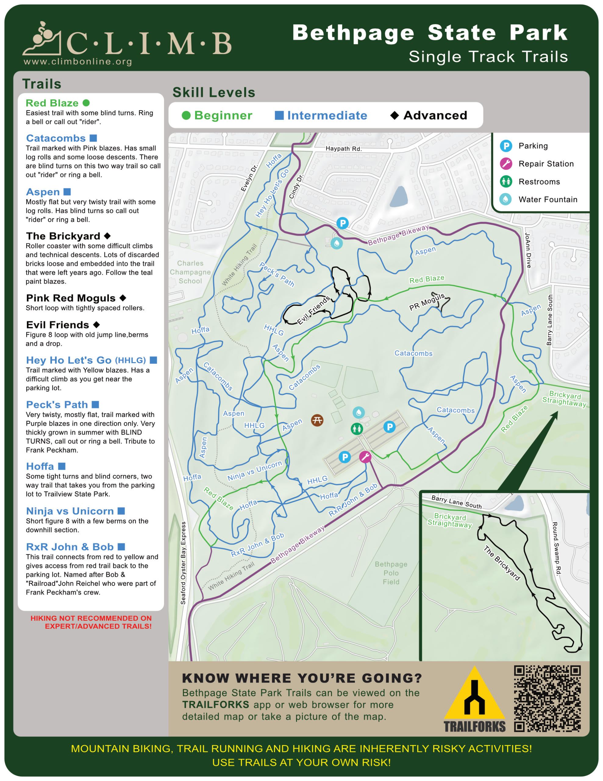
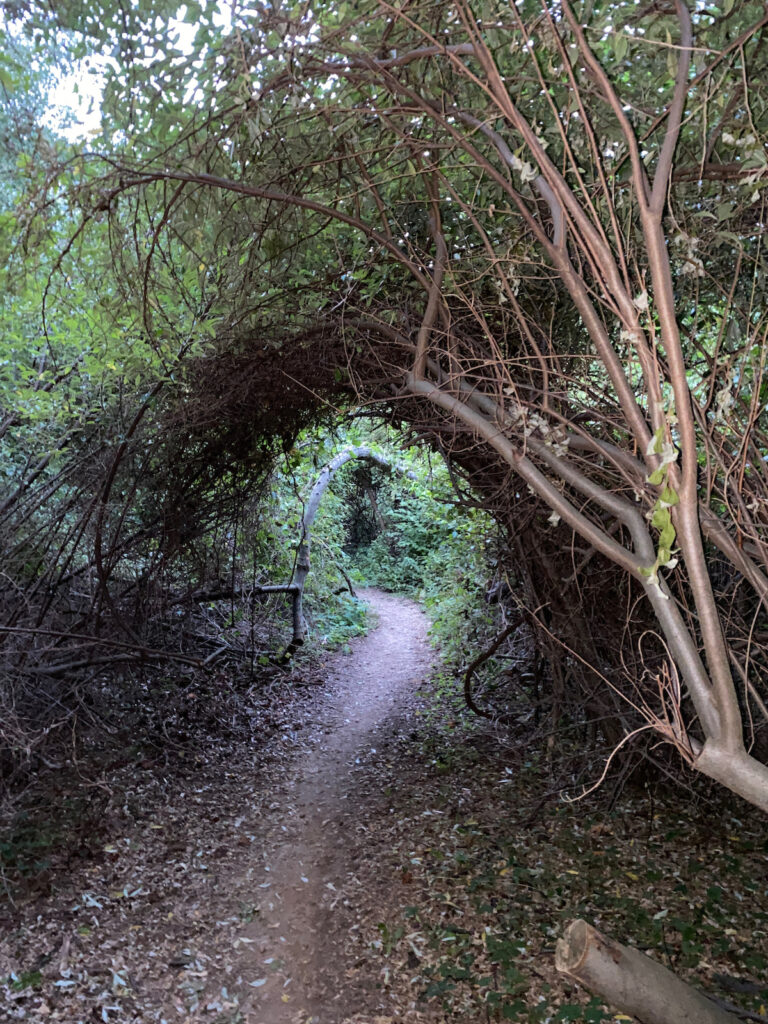
Well marked beginner to intermediate singletrack trails including a couple of more advanced, expert loops including The Brickyard, and Evil Friends loop to keep it interesting. Large parking lot, picnic areas and bathrooms. Please only ride marked trails, NO E-BIKES OR OTHER MOTORIZED VEHICLES are allowed on trails as per New York State Law. HELMET and eye protection required on the trail. Trails are mostly two way so call out or ring a bell around blind turns. Please respect the trails and don't ride when muddy.
SKILL LEVELS
Beginner
Intermediate
Trail View State Park
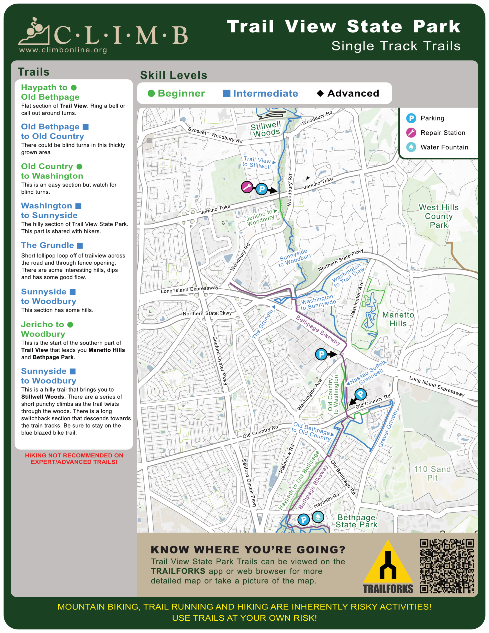
Trail View is a 400-acre, 7.4-mile linear park that serves as a link along the Nassau/Suffolk Greenbelt Trail that extends from Cold Spring Harbor State Park on the north shore of Suffolk County to Bethpage State Park, and eventually to the south shore of Nassau County.
New York State obtained the land in the 1960s intending to use it as a parkway connecting Caumsett State Historic Park to Bethpage State Park. In the summer of 2002, the property was dedicated as a state park, offering a variety of recreational opportunities including trails for hiking and bicycling on its hilly terrain and open fields.Trail View encompasses a variety of habitats and undeveloped natural resources such as hardwood forests, marshes and succession fields with elevations ranging from 60 to 300 feet above sea level.
SKILL LEVELS
Beginner
Intermediate
Manetto Hills Preserve
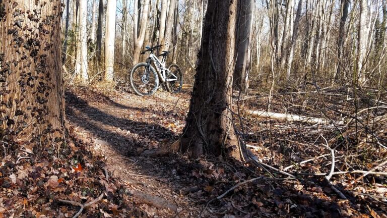
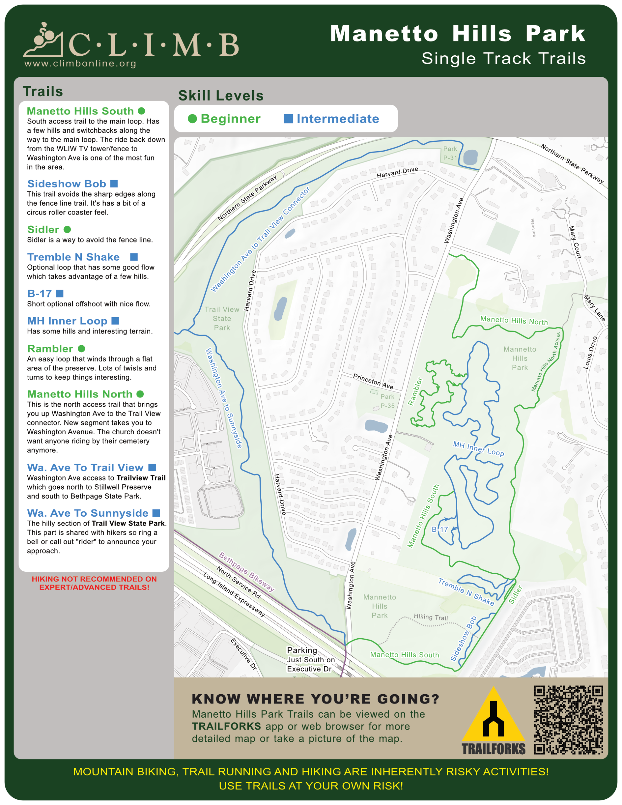
A mellow cross country type trail with a few optional loops. It's a lollipop loop where you go out to a one way loop then you return the same way. The downhill on the way back to the exit at the south side access is a fun way to end the ride.
SKILL LEVELS
Beginner
Intermediate
Advanced
Stillwell Woods
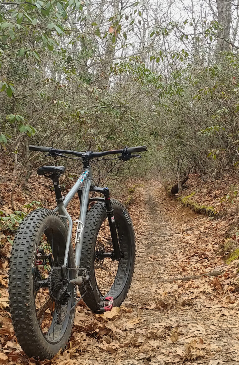
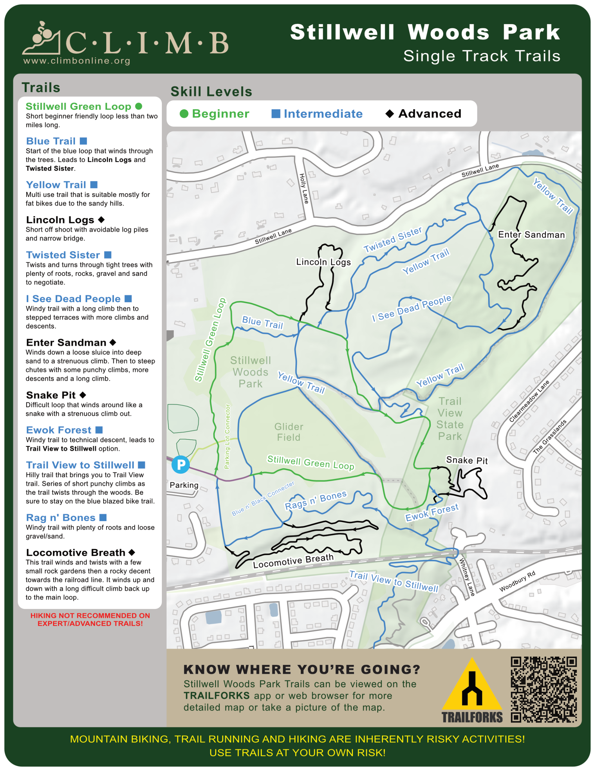
Stillwell Woods trails are one-way. If you don't see any markers, your going the wrong way. Stillwell has a two mile green beginners loop. There is also a nice easy loop around the inner field that you will only see if using the yellow or green trails. The main blue loop is considered more difficult and the black diamonds are the most difficult.
The climbs are short but moderately steep with a good deal of sand and gravel so they can be tough if you're not in the right gear. Most of the climbs are short and punchy but there are a few long ones too. Stillwell links up to Trail View State Park AKA: Nassau-Suffolk Greenbelt trail to the south. The greenbelt is an easier trail that will take you 8 miles south to Bethpage Park. Use a bell and call out when passing people.
SKILL LEVELS
Beginner
Intermediate
Advanced
Edgewood Oak Brush Plains
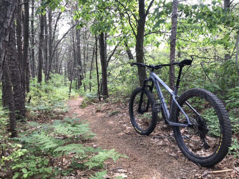
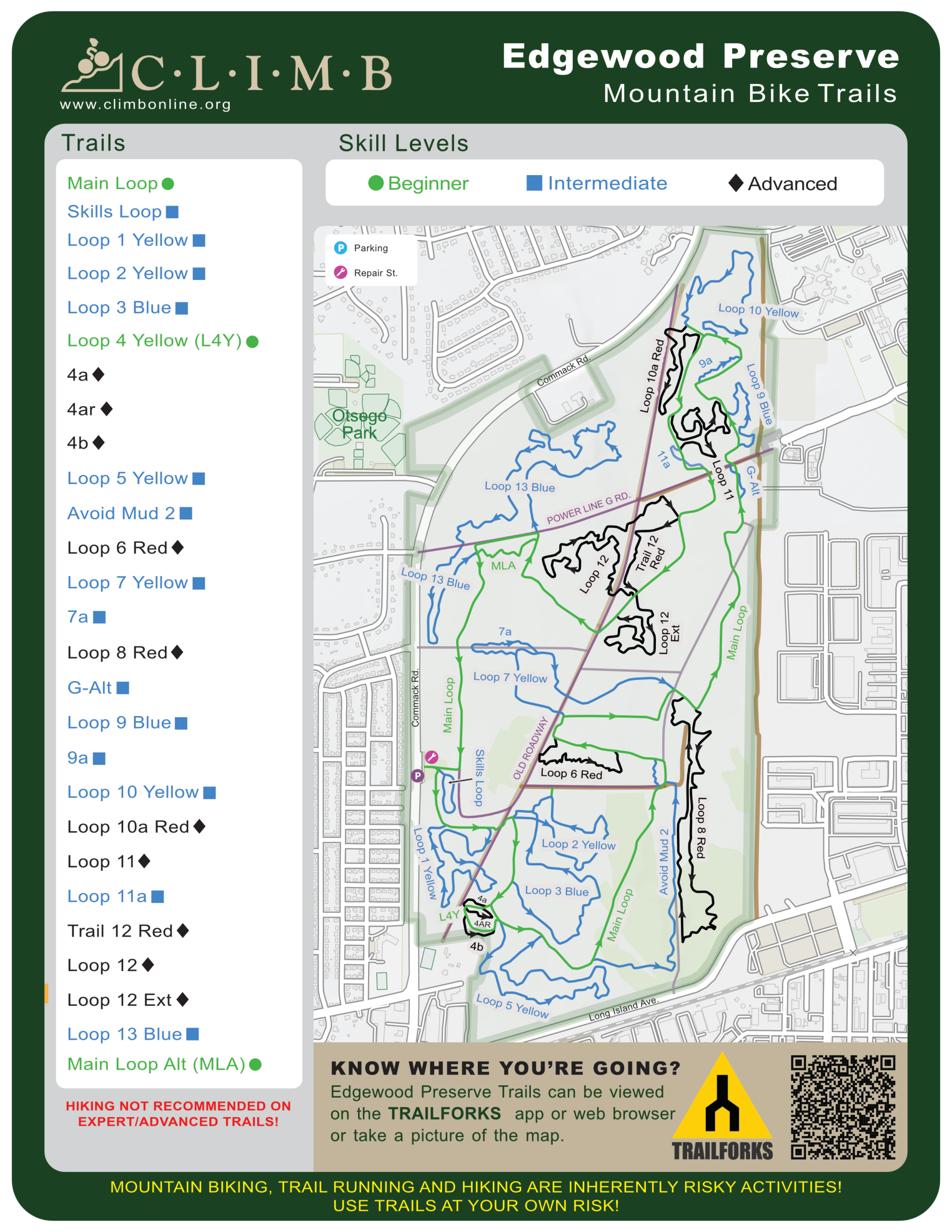
The preserve features a 5.5‑mile main white loop, the easiest route, with roughly 15 miles of optional, more difficult loops branching off and reconnecting to the main trail. Follow the white bicycle discs from the trailhead to complete the main loop; if you stop seeing markers, you’re off‑route or going the wrong way. The old abandoned roadway (purple on the map) offers a unique, kid‑friendly ride and serves as a bailout back to the parking lot, though it’s not maintained. Bypasses around large puddles are located along the sides of the trail.
Difficulty increases by blaze color: yellow trails are moderately harder than the main loop, blue trails are more challenging, and red trails are expert‑level with no bailouts or ride‑arounds—ride them at your own risk. The red trails are intentionally marked “red like blood” to emphasize their difficulty. Overall, the system offers a mix of family‑friendly terrain and advanced technical riding within a clearly marked, easy‑to‑navigate layout.
SKILL LEVELS
Beginner
Intermediate
Advanced
Meadowlark Park
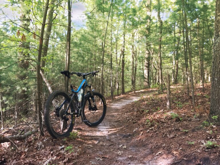
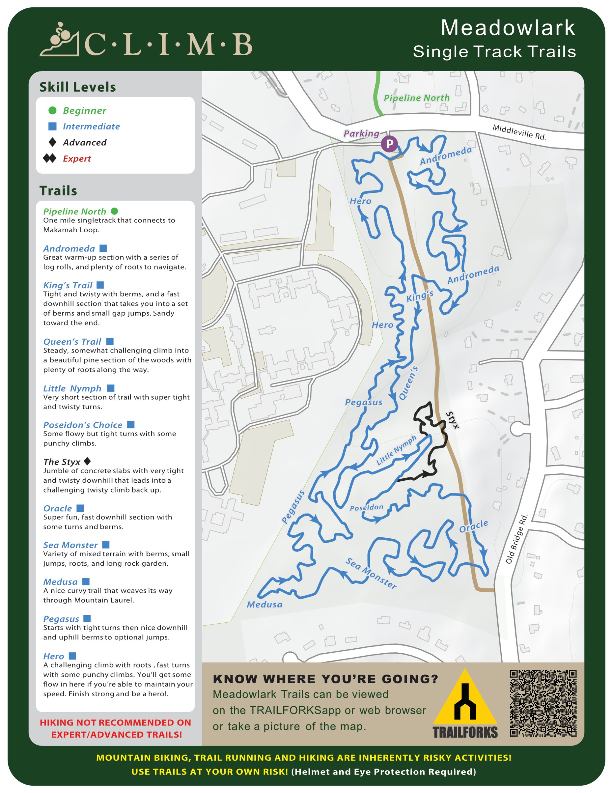
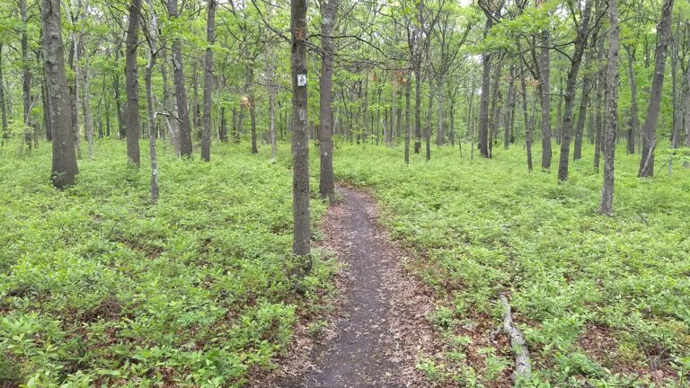
These trails are rated for intermediate ability and are more difficult.Ride these trails at your own risk. Tight and technical terrain with some hills to climb. It's a one way loop, follow blue blazes. You will find many logs to ride over, please leave them in place. They help control erosion. If you want easier trails, go to Caumsett or Sunken Meadow State Parks or Edgewood Preserve in Commack.
Horses may be on fire road crossings, speak up and be courteous. Horses are not allowed on the single track trails.
SKILL LEVELS
Intermediate
Advanced
Expert
Laurel Ridge Preserve
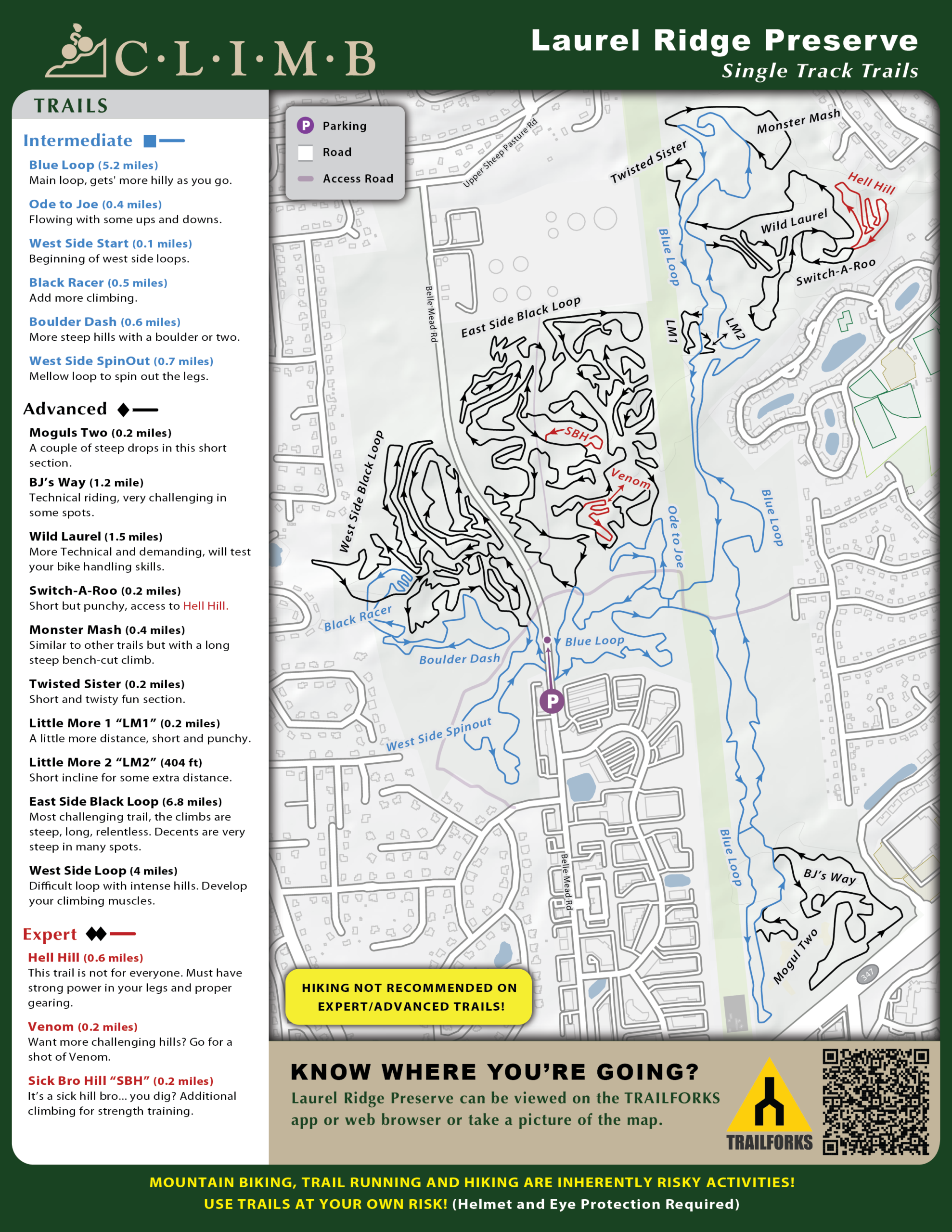
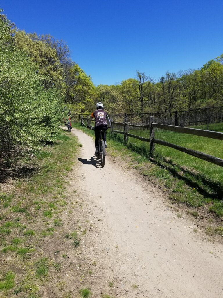
Intermediate to expert with 6 miles of optional diamond loops, featuring difficult hill climbs.
SKILL LEVELS
Intermediate
Advanced
Expert
Glacier Ridge
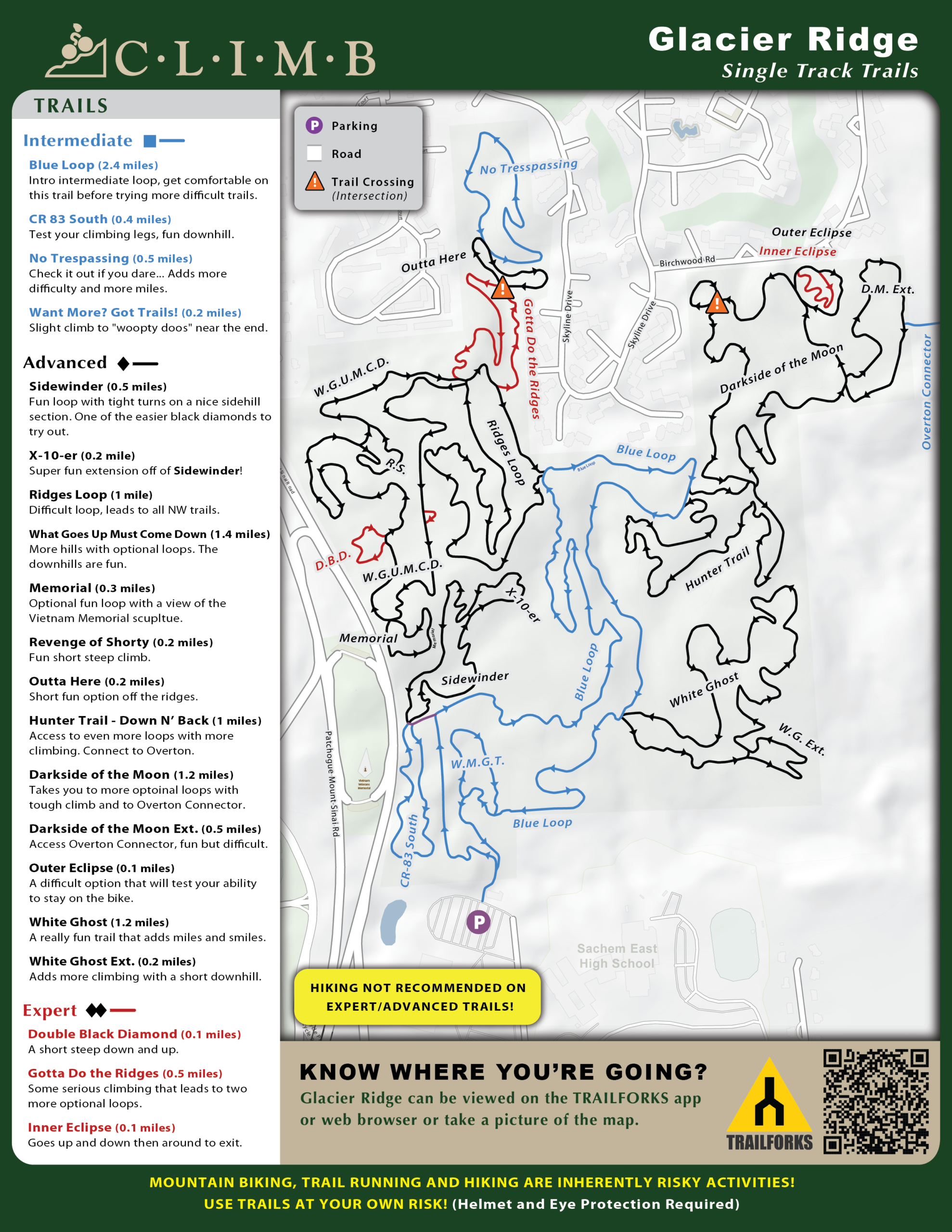
Fun trail network consisting of an intermediate main loop and around 8 miles of optional black diamonds. Tight and twisty with some decent downhills for LI.
SKILL LEVELS
Beginner
Intermediate
Advanced
Expert
Overton
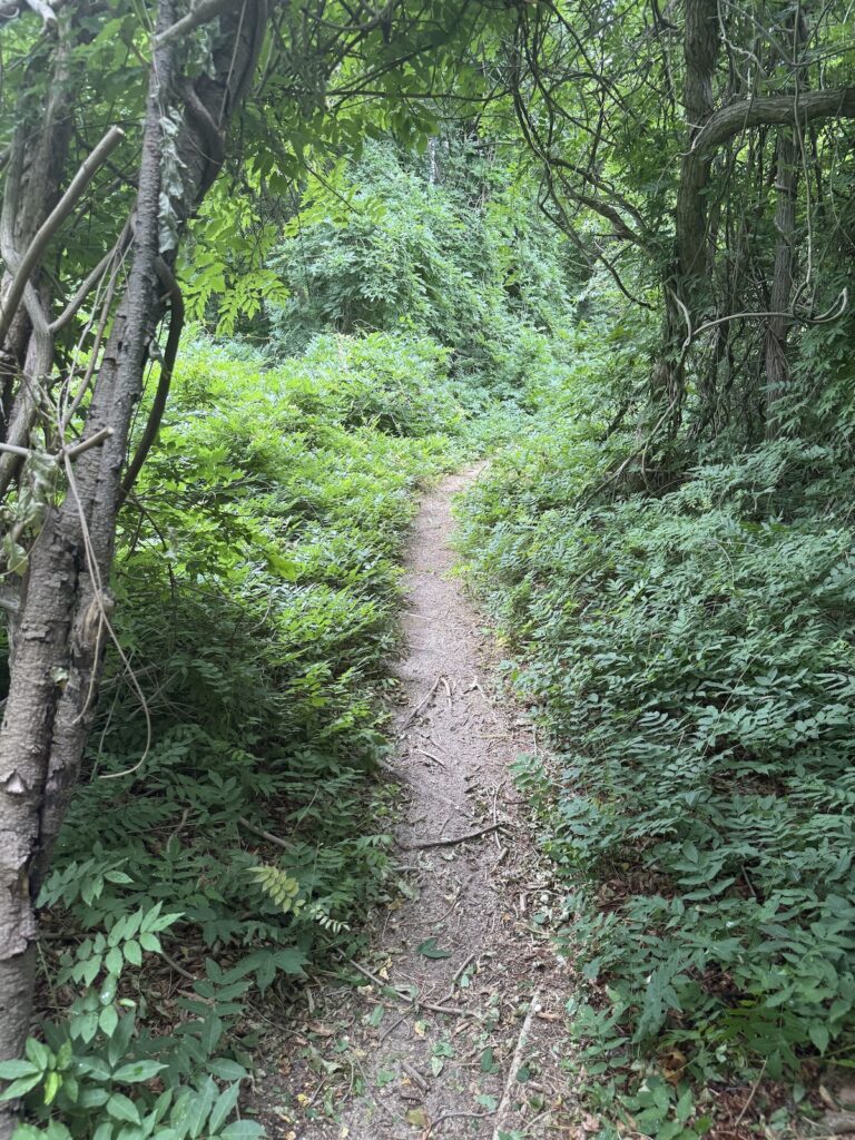
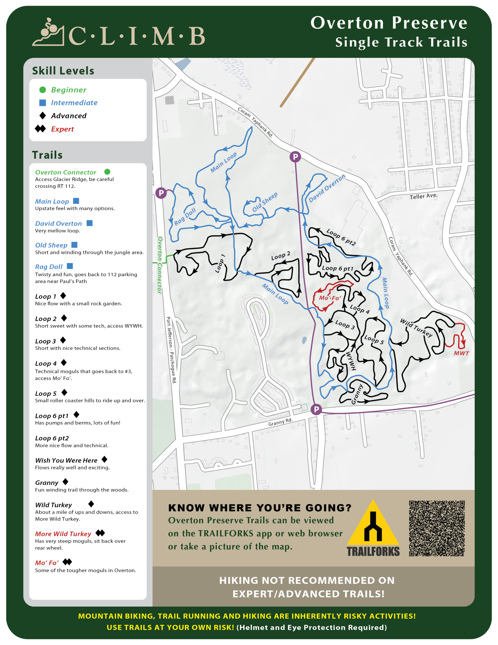
Overton is a fun trail system, the main loop is not too hard but there's an option to add some optional black diamonds for more difficulty. The area used to be a paintball venue so you may see some structures left over. Option to connect to Cathedral Pines Park and Glacier Ridge Preserve to create your own triple crown adventure.
SKILL LEVELS
Intermediate
Advanced
Cathedral Pines
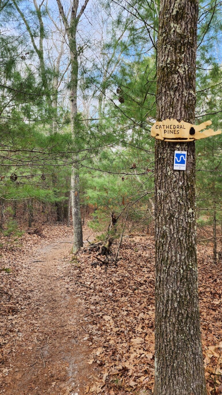
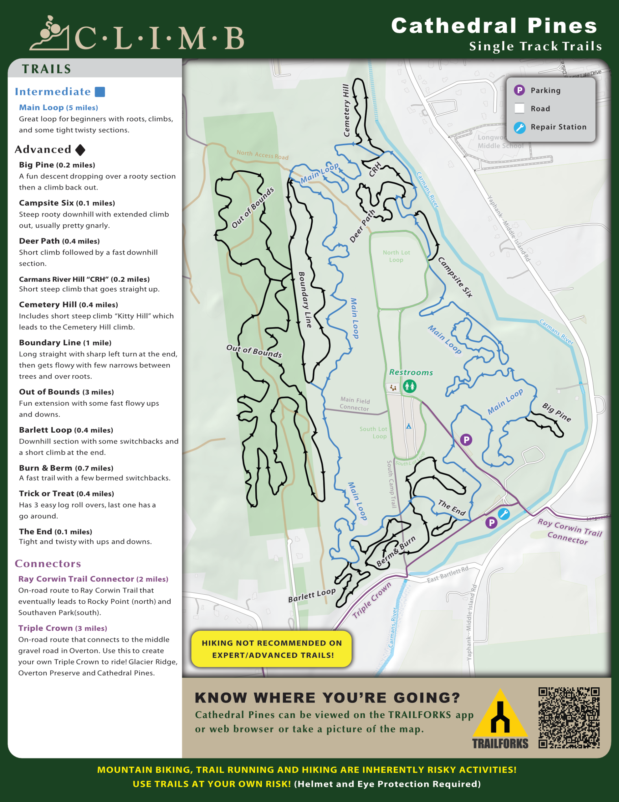
This 320 acre site is situated along the headwaters of the Carmans River. Facilities include campsites for individuals, youth group camping and club camping (10 or more units) and family camping, including 10 sites with water and electric hookups. Picnic sites and the George Broome Memorial Activity Building are also available. Adjacent to Cathedral Pines Park is Prosser Pines Nature Preserve, which features a majestic stand of white pines planted in 1812. Prosser Pines is a popular site for hikers and photographers.
Park provides access to a beginner to intermediate single track. 6-mile beginner loop with additional 5½ miles of optional advanced hill climbs. New 3 mile loop called Out Of Bounds adds more mileage.
SKILL LEVELS
Beginner
Intermediate
Advanced
Expert
Rocky Point
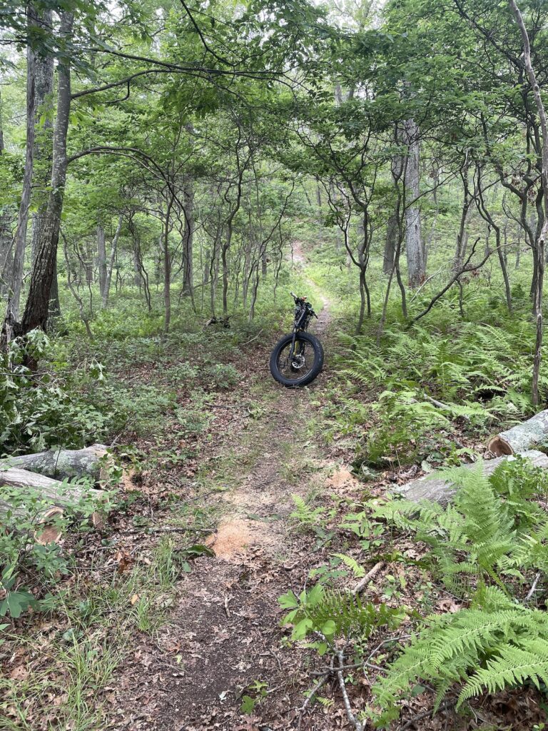
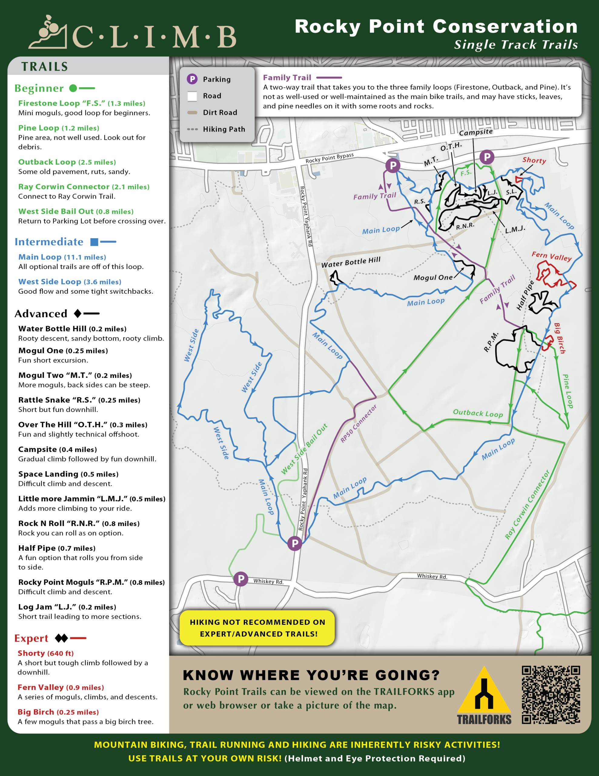
Bicycling is permitted on Rocky Point from April 1st through April 30th or May 1st through May 31st (afternoon only) and June 1st through October 31st due to hunting season.
Rocky Point Conservation area has over 22 miles of cross country trails including a family trail which is only accessible from the 25a By Pass parking lots. There are no rocks at Rocky Point, just miles of fast swoopy single track in a pine barrens setting. Optional black diamond loops can extend your ride. Bring lots of water and snacks. Helmets and eye protection are mandatory. The Parking Lots on the 25a By-Pass are the biggest lots with the one further east being the biggest. The lot on CR 21 is the smallest. Please do not park on the side of the road on CR 21 or in the designated hunting spots.
SKILL LEVELS
Beginner
Intermediate
Advanced
Calverton Pine Barrens
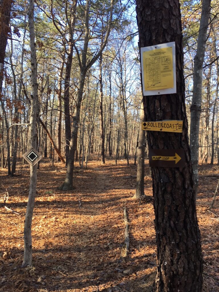
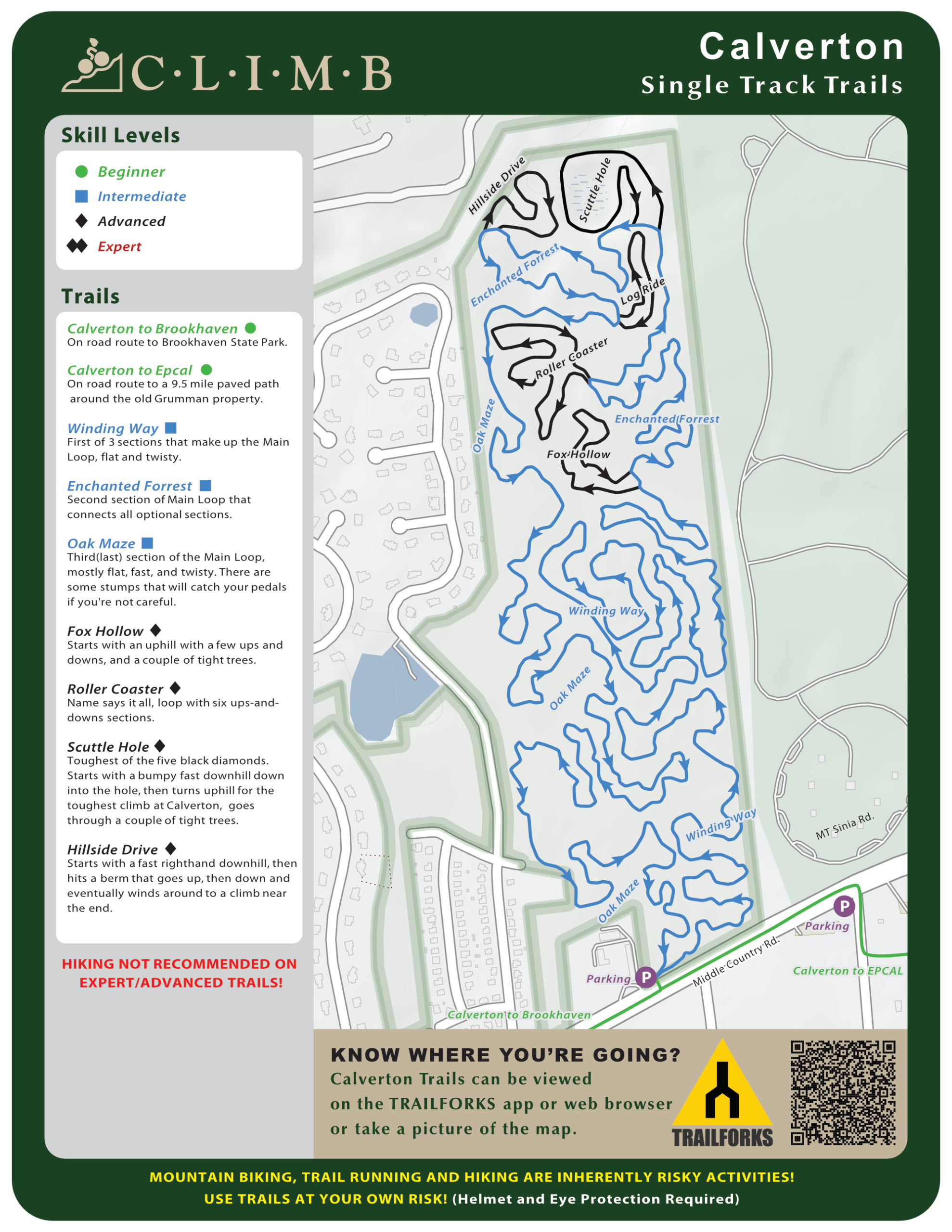
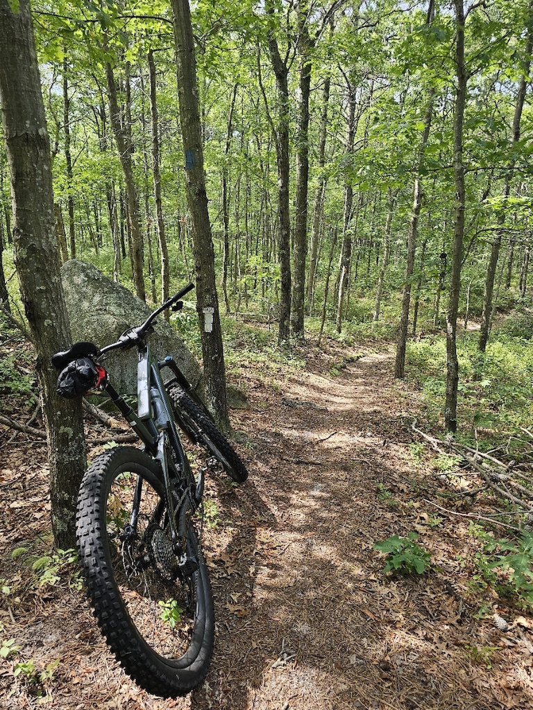
This is one of the easier trails on Long Island. It is primarily a Beginner- to Intermediate-Level singletrack trail. The Main Loop is about 7.5 miles. The five black diamond sections add a couple of miles total. There are lots of twists and turns, some tight trees. This trail is often covered with pine needles, leaves, and small branches. In the late Spring through Summer, Box Turtles are often on the trail. Turkeys and deer are common, too. Check for ticks as you ride this trail, especially in early Summer.
SKILL LEVELS
Intermediate
Advanced
Manorville Hills
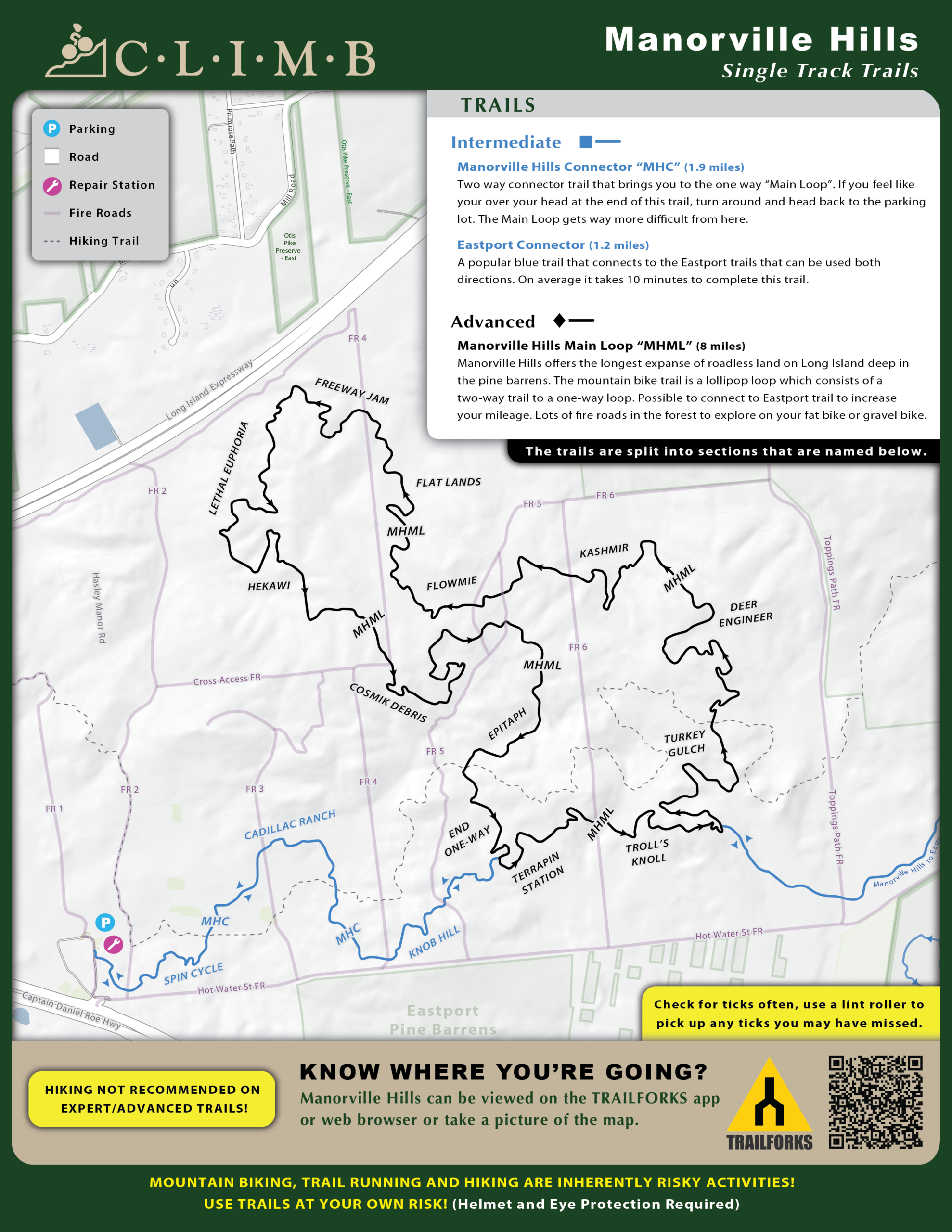
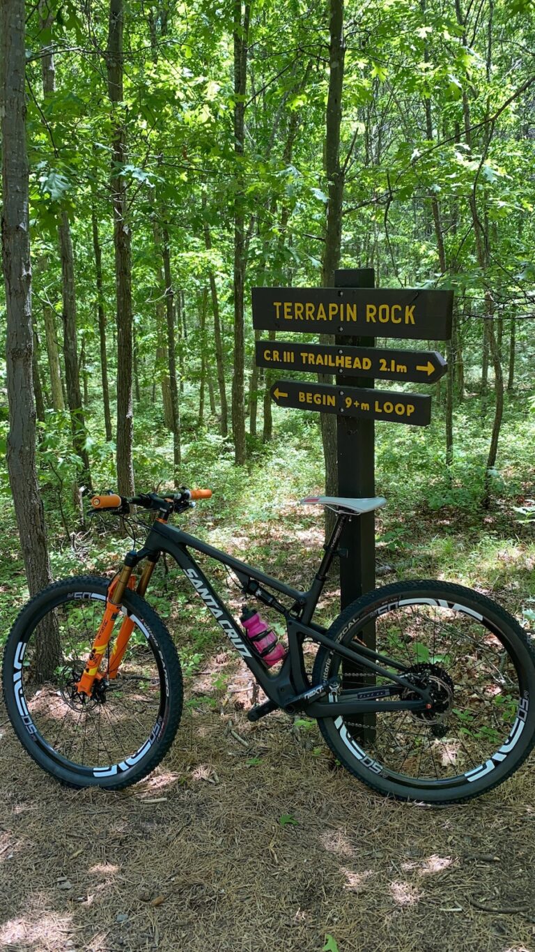
Manorville Hills offers the longest expanse of roadless land on Long Island deep in the pine barrens. Trailhead parking is on the east side of County Route 111 and provides access to separate loop trails for hikers, mountain bikers and horse riders.The mountain bike trail is a lollipop loop which consists of a two - way two mile trail to a one way loop. Possible to connect to Eastport trail to increase your mileage. Lots of fire roads in the forest to explore on your fat bike or gravel bike. Be sure to check for ticks often, use a lint roller after riding to pick up any ticks you may have missed.
SKILL LEVELS
Beginner
Intermediate
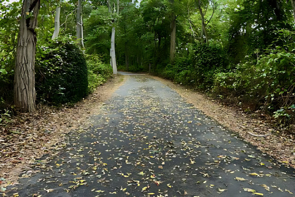
Eastport Conservation
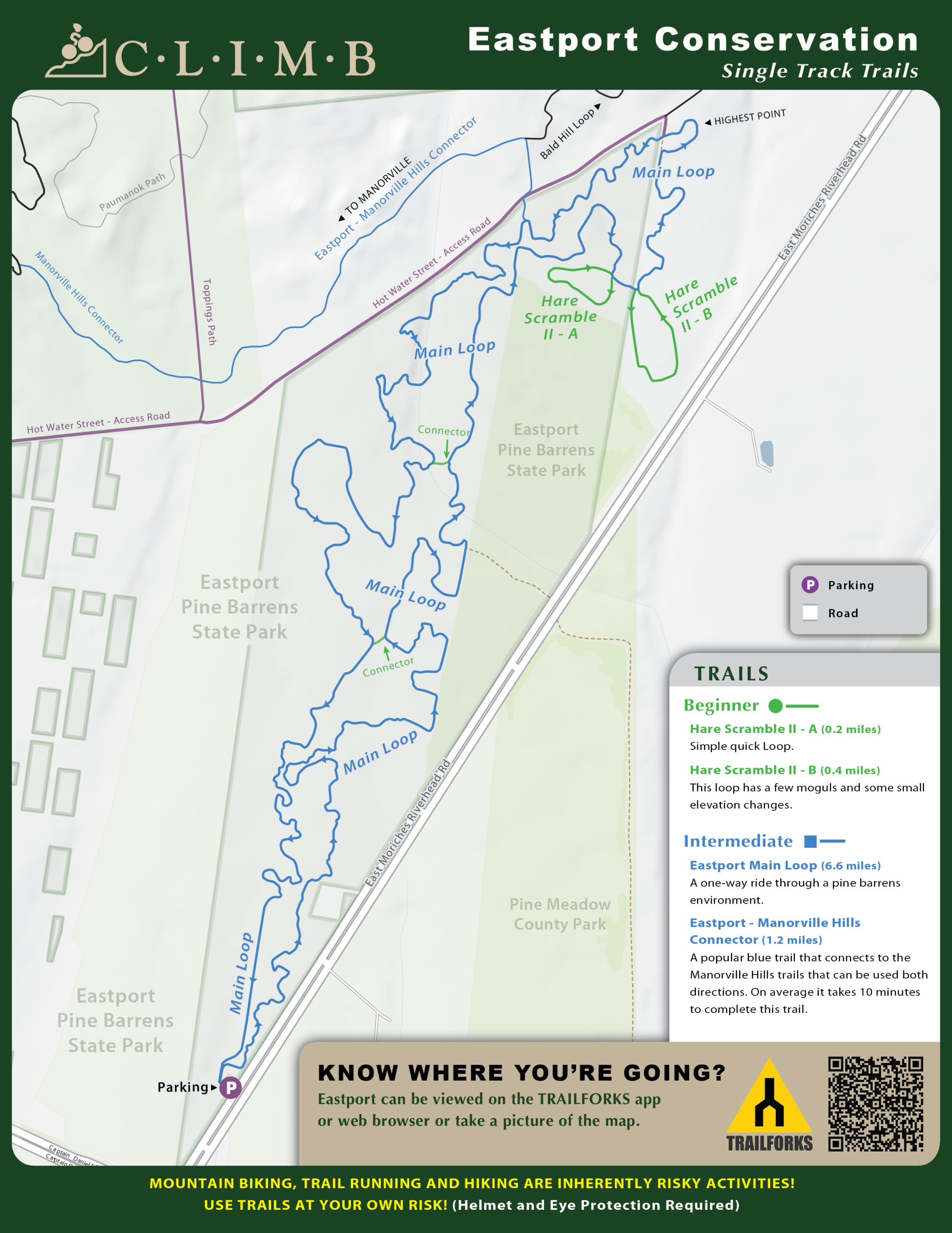
Eastport Loop is a 7 mile popular blue difficulty singletrack trail located near Eastport New York. This mountain bike primary trail can be used one direction and has a moderate overall physical rating with a 267 ft blue climb. Trail visibility is always easy to follow. On average it takes 31 minutes to complete this trail.
DETAILS
Miles: 13.2 miles (one way)
Bethpage Bikeway
Long Island's premier north-south paved spine. It is entirely asphalted and mostly tree-lined, winding south from Woodbury, cutting straight through the heart of Bethpage State Park, and concluding alongside the scenic lakes of the Massapequa Preserve.
Start Point: Trail View State Park (Woodbury Rd & Manetto Hill Rd, Woodbury)
End Point: Massapequa Preserve (Merrick Rd & Ocean Ave, Massapequa
Parking Locations : (there are more)
North: Trail View State Park dirt lot (Woodbury Rd).
Central: Bethpage State Park Picnic Area Lot (Vehicle fee applies during peak season).
South: Massapequa LIRR station lot or the Massapequa Preserve lot off Sunrise Highway.


DETAILS
Miles: 5.4 miles (one way)
Jones Beach Bikeway
A completely flat, sun-exposed asphalt path that runs parallel to the Wantagh State Parkway. It carries riders over three bridges spanning the marshlands and tidal creeks of the Great South Bay, directly hitting the beach.
Start Point: Cedar Creek Park (Merrick Rd, Seaford)
End Point: Jones Beach State Park (East of the water tower / Boardwalk)
Parking Locations :
North: Cedar Creek Park (Free parking in designated fields)
South: Jones Beach Field 5 or Field 6 ($10 vehicle use fee collected during summer hours)

DETAILS
Miles: 14.2 miles (one way)
Ocean Parkway Greenway
A completely flat, sun-exposed asphalt path that runs parallel to the Wantagh State Parkway. It carries riders over three bridges spanning the marshlands and tidal creeks of the Great South Bay, directly hitting the beach.
Start Point: Jones Beach State Park West End 2
End Point: Captree State Park (Babylon)
Parking Locations :
West: Jones Beach Fields 3, 4, 5, or West End
Central: Tobay Beach lot (Town of Oyster Bay permit required in summer, open to all off-season)
East: Captree State Park Main Lot ($8 vehicle fee applies)
DETAILS
Miles: 10 miles (one way)
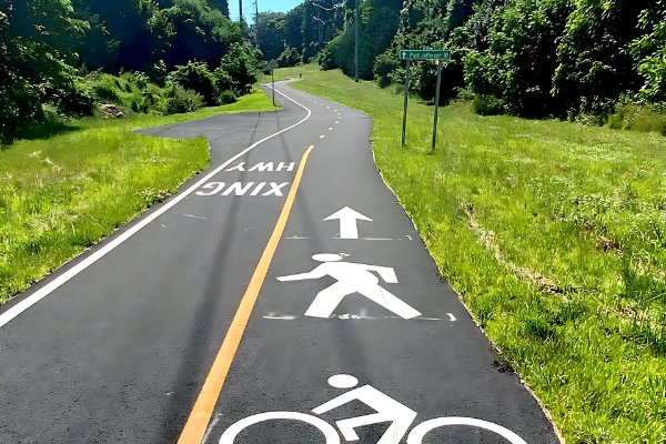
North Shore Rail Trail
Built on a historic former Long Island Railroad right-of-way, this features a pristine 10-foot-wide center paved strip. It cuts through residential areas and canopy woods across the North Shore, running entirely isolated from car traffic.
Start Point: Crystal Brook Hollow Rd (Mount Sinai)
End Point: Wading River Manor Rd (Wading River)
Parking Locations :
West: Trailhead lot at Crystal Brook Hollow Road / Route 25A intersection
Central: Recreational lot on Rose Executive Blvd (East Setauket) or the parallel shopping plazas off Route 25A
DETAILS
Miles: 1.4 miles (one way)
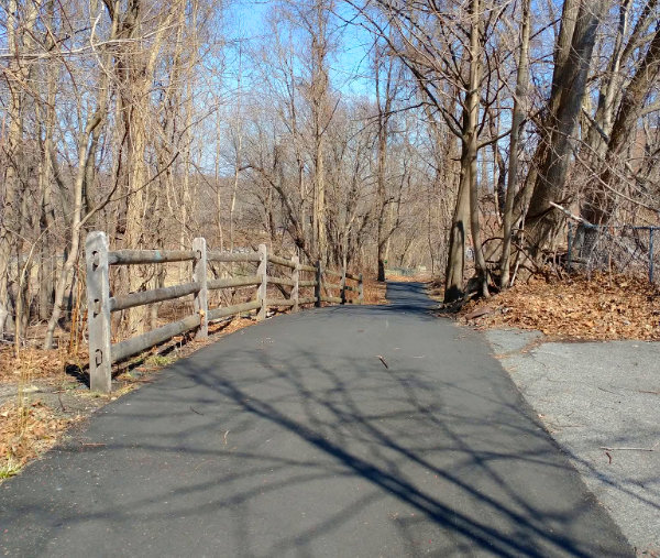
Kings Park Hike & Bike Trail
A hidden, short, but highly scenic asphalt path built over an old rail spur line. It cuts deep through rolling, mature woodlands before gently dropping you off directly on the banks of the Nissequogue River.
Start Point: Kings Park LIRR Station / Main St Lot
End Point: Nissequogue River State Park
Parking Locations :
South: Kings Park downtown municipal lots or the LIRR station
North: Nissequogue River State Park main parking fields ($8 vehicle fee)
DETAILS
Miles: 3.1 miles (one way)
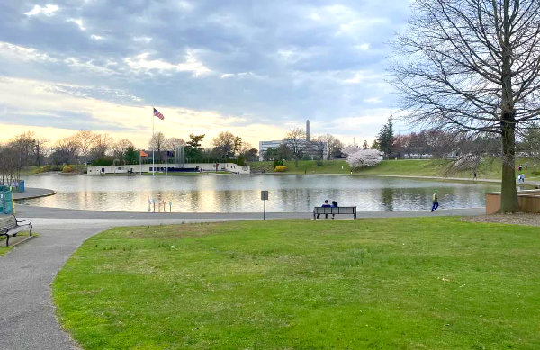
Eisenhower Park Multi-Use Paths
An expansive system of fully separated, flat paved loops circumscribing the major fields and golf courses inside Nassau County’s central park hub. Perfect for short time trials, casual family pacing, and flat speed work.
Start Point/End Point: Continuous loop within the park perimeter
Parking Locations :
Eisenhower Park Fields 1, 2, and 4 (Free access from Merrick Ave or Stewart Ave entrances)
Current Trail Conditions
& Updates
Staying informed is key to enjoying our outdoor trails safely. Visit our Facebook or Instagram profile for most current updates on trail conditions such as closures, helping you plan your adventures better. Check often for the latest changes in trail status and be prepared for a great experience!
Help Us Keep the Trails Great!
Join our community of trail riders and volunteer today!
Volunteer as a Trail Ambassador or Trail Steward or Adopter or Trail Patrol or attend at a trail maintenance event! There are many ways to contribute according to how involved you'd like to be and your schedule.
Trail Safety Tips
Whether you're biking or hiking, safety should always come first. Stay on marked paths, and make sure to let someone know your plans before you head out. Always carry plenty of water and snacks, and keep an eye on the weather. Knowing your limits is just as important as being equipped. Remember, the trails are here for everyone to enjoy, but safety ensures that we all can.
Stay Aware
Pay attention to your surroundings while on the trail. Look out for other trail users — whether they’re on bikes or foot. Respect the environment by sticking to the paths. It's crucial to keep wildlife wild, so maintain a safe distance. Awareness isn’t just about being safe; it’s about enjoying and preserving the beauty around you.
Our community shares their thoughts
“Being part of this organization has truly changed my perspective on outdoor activities. The events are well-organized and I always feel welcome. It’s great to be among like-minded people who care about our trails and community.”
Jane Doe
Participating in community events.
“I’ve learned so much about trail safety and conservation. This group makes it easy to get involved and make a difference while enjoying the great outdoors!”
John Smith
Taking part in trail maintenance.